'Freehold Development Opportunity', Maidstone
Introduction
The photograph on this page of 'Freehold Development Opportunity', Maidstone by Robin Webster as part of the Geograph project.
The Geograph project started in 2005 with the aim of publishing, organising and preserving representative images for every square kilometre of Great Britain, Ireland and the Isle of Man.

There are currently over 7.5m images from over 14,400 individuals and you can help contribute to the project by visiting https://www.geograph.org.uk
'Freehold Development Opportunity', Maidstone
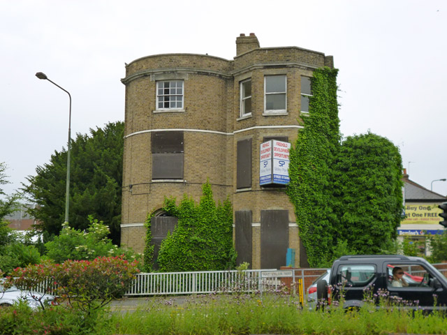
Image: © Robin Webster Taken: 27 Jun 2012
A building of some age, unlisted nationally. It was mapped as 'Maidstone Ex-Services Club' in 1967, but appears to have been here since Victorian times, apparently just as a house then. It might be called a folly from this aspect, with a bizarre conjunction of semi-circular and semi-octagonal bays. The foreground road is fairly new, built through the building's former grounds.
Images are licensed for reuse under creativecommons.org/licenses/by-sa/2.0
Image Location
Latitude
51.273017
Longitude
0.529219