Norton Cottages
Introduction
The photograph on this page of Norton Cottages by Martin Tester as part of the Geograph project.
The Geograph project started in 2005 with the aim of publishing, organising and preserving representative images for every square kilometre of Great Britain, Ireland and the Isle of Man.
There are currently over 7.5m images from over 14,400 individuals and you can help contribute to the project by visiting https://www.geograph.org.uk

Image: © Martin Tester Taken: Unknown
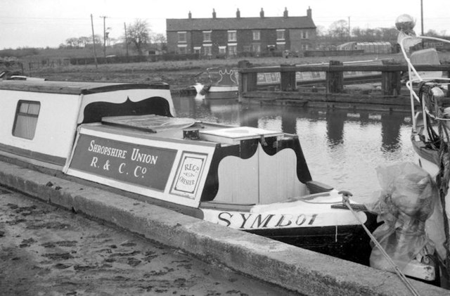
Looking across Norton Basin onto the rear elevation of Norton Cottages. At the time of the photo these were the only houses near the basin. Since then the area has experienced massive redevelopment as more recent photos here will show. In the immediate foreground is the stern of 'Symbol' - originally a Shropshire Union Railway's & Canal Company horsedrawn 'fly' boat & then one of the few remaining examples. Sadly this historic craft has not survived, a well-meaning restoration plan failed as is described here: http://www.canaljunction.com/mainline/0112.htm

