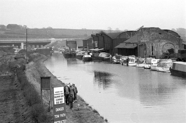
Norton Warehouses, Bridgewater Canal, from Cawley's Bridge
Introduction
The photograph on this page of Norton Warehouses, Bridgewater Canal, from Cawley's Bridge by Martin Tester as part of the Geograph project.
The Geograph project started in 2005 with the aim of publishing, organising and preserving representative images for every square kilometre of Great Britain, Ireland and the Isle of Man.
There are currently over 7.5m images from over 14,400 individuals and you can help contribute to the project by visiting https://www.geograph.org.uk

Image: © Martin Tester Taken: Unknown
View from Cawley's Bridge Image looking SE along the Bridgewater Canal towards its junction with the Trent & Mersey Canal. In the distance is the newly-opened M56 motorway. Since the time of the photo this area has seen massive redevelopment as more recent photos will show. On the left a marina has been excavated & on the right Preston Brook Marina Village has been built. Of the 4 decrepit-looking warehouses only the 3rd along survives; between it & the 4th warehouse lies Norton Basin. Beyond the 4th warehouse the steel sheeting indicates engineering work & a temporary narrowing of the canal which allowed me to take a photo from the opposite direction, see: Image

