
Lower Lough Erne, Rough Islands and White Cairn
Introduction
The photograph on this page of Lower Lough Erne, Rough Islands and White Cairn by David Dixon as part of the Geograph project.
The Geograph project started in 2005 with the aim of publishing, organising and preserving representative images for every square kilometre of Great Britain, Ireland and the Isle of Man.

There are currently over 7.5m images from over 14,400 individuals and you can help contribute to the project by visiting https://www.geograph.org.uk
Lower Lough Erne, Rough Islands and White Cairn
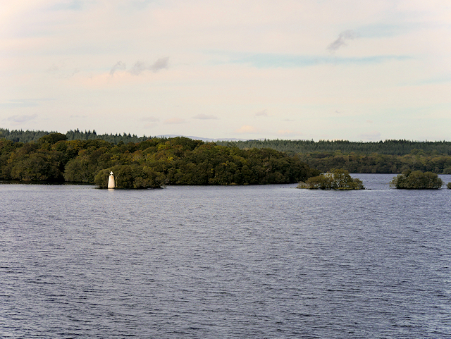
Image: © David Dixon Taken: 25 Sep 2017
Lough Erne (Loch Éirne) is the name of two connected freshwater lakes in County Fermanagh. It is the second-biggest lake system in Northern Ireland and Ulster, and the fourth biggest in Ireland. The lakes are widened sections of the River Erne, which flows north and then curves west into the Atlantic. The smaller southern lake is called the Upper Lough as it is higher up the river whilst the bigger northern lake is called the Lower Lough or Broad Lough. The town of Enniskillen lies on the short stretch of river between the lakes. During the Second World War, Sunderland flying boats based at RAF Castle Archdale, on the eastern shore of Lower Lough Erne, patrolled the North Atlantic to protect shipping convoys against German U-boats. A secret agreement with the government of Ireland allowed aircraft to fly from Lough Erne to the Atlantic along the Donegal Corridor, providing vital air cover from one of the most westerly RAF bases in the United Kingdom (see Image). Perhaps this large round marker was used to aid their navigation?
Images are licensed for reuse under creativecommons.org/licenses/by-sa/2.0
Image Location

Latitude
54.476587
Longitude
-7.956167