Burradon Tower
Introduction
The photograph on this page of Burradon Tower by Graham Robson as part of the Geograph project.
The Geograph project started in 2005 with the aim of publishing, organising and preserving representative images for every square kilometre of Great Britain, Ireland and the Isle of Man.

There are currently over 7.5m images from over 14,400 individuals and you can help contribute to the project by visiting https://www.geograph.org.uk
Burradon Tower
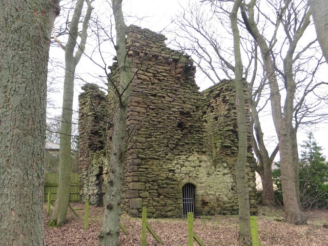
Image: © Graham Robson Taken: 13 Jan 2018
The remains of an old fortified house in a copse adjacent to the farm steading at Burradon House. The ruins are a Scheduled Monument. Link to Historic England listing page: https://historicengland.org.uk/listing/the-list/list-entry/1018644
Images are licensed for reuse under creativecommons.org/licenses/by-sa/2.0
Image Location


Leaflet Map data © OpenStreetMap
Latitude
55.050912
Longitude
-1.568911