Replacement wall, St Augustine?s Road
Introduction
The photograph on this page of Replacement wall, St Augustine?s Road by John Baker as part of the Geograph project.
The Geograph project started in 2005 with the aim of publishing, organising and preserving representative images for every square kilometre of Great Britain, Ireland and the Isle of Man.

There are currently over 7.5m images from over 14,400 individuals and you can help contribute to the project by visiting https://www.geograph.org.uk
Replacement wall, St Augustine?s Road
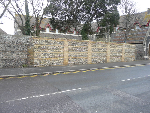
Image: © John Baker Taken: 31 Dec 2017
Planning permission was granted by Thanet District Council under application number L/TH/17/0509 for an “application for listed building consent for the erection of a 2.3m replacement wall” at St Augustine’s Abbey. Lime mortar was used in the construction of the wall, as it had been used in the construction of the former wall. This wall and the Abbey are grade II listed. This image shows the Image
Images are licensed for reuse under creativecommons.org/licenses/by-sa/2.0
Image Location
Latitude
51.328572
Longitude
1.409465