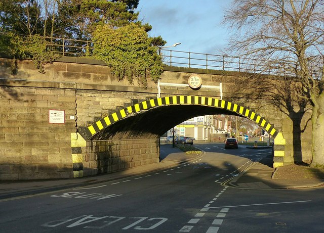
Tamworth Road railway bridge, Sawley
Introduction
The photograph on this page of Tamworth Road railway bridge, Sawley by Alan Murray-Rust as part of the Geograph project.
The Geograph project started in 2005 with the aim of publishing, organising and preserving representative images for every square kilometre of Great Britain, Ireland and the Isle of Man.
There are currently over 7.5m images from over 14,400 individuals and you can help contribute to the project by visiting https://www.geograph.org.uk

Image: © Alan Murray-Rust Taken: 1 Jan 2018
Built in 1839 for the Midland Counties Railway. Listed Grade II it has historical significance as a very early example of a skew arch. See https://historicengland.org.uk/listing/the-list/list-entry/1417676 for the very comprehensive description of the history of the bridge. A feature of the bridge has always been its very restricted headroom, which has always prevented the use of double deck buses. Local operator Barton Transport experimented with an ultra-low-height bus http://www.old-bus-photos.co.uk/?p=36241 but were never permitted to use it on services under the bridge. As can be seen in the picture, even with the roadway dipping to a lower level under the bridge the allowed height is only 12 ft 3 inches/3.7 metres. Even when first built this was a problem, as the turnpike trustees were concerned about flooding and insisted on a second small arch alongside (at normal ground level) but of course more restricted headroom still. See http://www.geograph.org.uk/photo/55101

