Pipe Bridge over the River Clyde and Daldowie Doocot
Introduction
The photograph on this page of Pipe Bridge over the River Clyde and Daldowie Doocot by Richard Sutcliffe as part of the Geograph project.
The Geograph project started in 2005 with the aim of publishing, organising and preserving representative images for every square kilometre of Great Britain, Ireland and the Isle of Man.

There are currently over 7.5m images from over 14,400 individuals and you can help contribute to the project by visiting https://www.geograph.org.uk
Pipe Bridge over the River Clyde and Daldowie Doocot
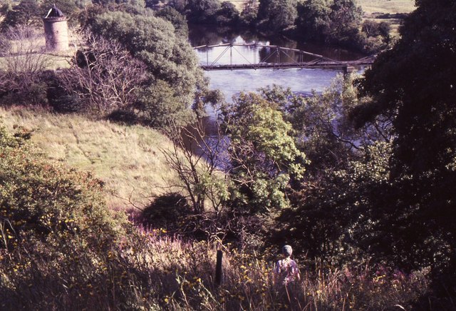
Image: © Richard Sutcliffe Taken: 24 Aug 1987
Seen from the edge of Kenmuir Wood. The tower on the left is the 18th century Category A listed Daldowie Doocot. It is in its original location prior to being dismantled and moved to a new site in 2000 [http://www.geograph.org.uk/photo/955727].
Images are licensed for reuse under creativecommons.org/licenses/by-sa/2.0
Image Location
Latitude
55.831892
Longitude
-4.128184