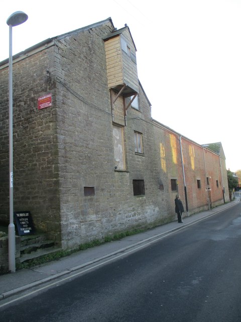
Gundry Lane bonded warehouse
Introduction
The photograph on this page of Gundry Lane bonded warehouse by John Stephen as part of the Geograph project.
The Geograph project started in 2005 with the aim of publishing, organising and preserving representative images for every square kilometre of Great Britain, Ireland and the Isle of Man.
There are currently over 7.5m images from over 14,400 individuals and you can help contribute to the project by visiting https://www.geograph.org.uk

Image: © John Stephen Taken: 28 Dec 2017
Still used by Palmers Brewery, I assume because I've seen their employees repairing guttering etc. Mid C19. Bonded warehouse. East and west ends hammer dressed stone, centre red brick. Various pitched slate roofs. 2 storeys and attic. East side has 3 barred windows and 1 sash on 1st floor. North elevation is gabled at either end has 1 planked winch hoist jettied out from attic storey and 1 range of casements at east end: ground floor has 6 barred windows and 1 planked double door with original massive lock and "Customs and Excise Duty Free Warehouse" painted on. West elevation has planked loading door. Tarred projection to south with various barred windows and planked loading door: this in turn has extension on east side with catslide roof and 3 barred windows stepped to follow line of roof. 2 storey rendered extension in east re-entrant angle with 1 casement and 1 sash with glazing bars. East range has 4 barred windows and 1 planked loading door on its inner side.

