Strathbogie Parish Church, Huntly
Introduction
The photograph on this page of Strathbogie Parish Church, Huntly by Bill Harrison as part of the Geograph project.
The Geograph project started in 2005 with the aim of publishing, organising and preserving representative images for every square kilometre of Great Britain, Ireland and the Isle of Man.

There are currently over 7.5m images from over 14,400 individuals and you can help contribute to the project by visiting https://www.geograph.org.uk
Strathbogie Parish Church, Huntly
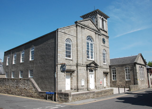
Image: © Bill Harrison Taken: 29 May 2016
The former 'non-intrusion' Huntly kirk from 1840-41, when most of the Established congregation at Huntly 'came out' in sympathy with the congregation at Marnoch, some 10 km to the north-east in a row over patronage (see Thomas Brown: Annals of the Disruption, 1892 edition, p. 22, available from archive.org), and an important event leading to the 1843 Disruption (https://en.wikipedia.org/wiki/Disruption_of_1843 ; the Huntly congregation joined the free kirk at that point. The Italianate front dates from 1862. B listed (LB34955): http://portal.historicenvironment.scot/designation/LB34955 . Next door is the 'prayer hall'.
Images are licensed for reuse under creativecommons.org/licenses/by-sa/2.0
Image Location
Latitude
57.446886
Longitude
-2.782905