
Cwmduad village
Introduction
The photograph on this page of Cwmduad village by David Purchase as part of the Geograph project.
The Geograph project started in 2005 with the aim of publishing, organising and preserving representative images for every square kilometre of Great Britain, Ireland and the Isle of Man.

There are currently over 7.5m images from over 14,400 individuals and you can help contribute to the project by visiting https://www.geograph.org.uk
Cwmduad village
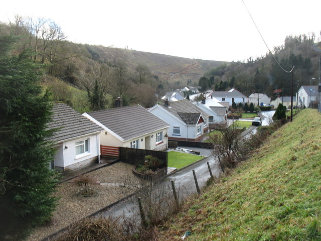
Image: © David Purchase Taken: 27 Dec 2017
A rather straggly village along the A484, here confined within the narrow valley of the Afon Clodd but shortly to merge with the Afon Duad and, further downstream, the Afon Gwilt. Those who are not experts on Welsh rivers (and that includes me) may not have heard of any of these. All I can say is that the Gwilt flows into the Twyi (which you probably will know) and thence into Carmarthen Bay. Even given the constraints of road-building in Wales, to give this road an 'A' classification is, to put it mildly, rather generous. For long stretches, if you meet anything wider than a van, significant care is needed. When two lorries meet, just prepare for a significant delay.
Images are licensed for reuse under creativecommons.org/licenses/by-sa/2.0
Image Location

Latitude
51.955769
Longitude
-4.365212