Perry Road, Nottingham, NG5
Introduction
The photograph on this page of Perry Road, Nottingham, NG5 by David Hallam-Jones as part of the Geograph project.
The Geograph project started in 2005 with the aim of publishing, organising and preserving representative images for every square kilometre of Great Britain, Ireland and the Isle of Man.

There are currently over 7.5m images from over 14,400 individuals and you can help contribute to the project by visiting https://www.geograph.org.uk
Perry Road, Nottingham, NG5
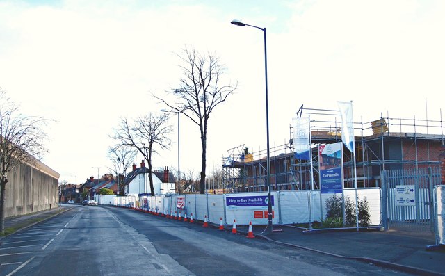
Image: © David Hallam-Jones Taken: 26 Dec 2017
Perry Road connects Sherwood and Basford. This is a view towards the junction with Victoria Road (next right hand turning). The boundary wall of H.M.P. Nottingham is seen on the left, with a former Factory and Warehouse site on the left. The prison was closed in 1930 and reopened as a borstal in 1932. In 1950 it reverted to being a maximum security prison. New houses are currently being constructed on the left on a site identified on a 1912 map as the "Sherwood (Bleaching, Dyeing and Dressing) Works. Although the premises later became a factory and warehouse the site was cleared in 2009-10 and the plot left unused until now. Behind the photographer are some other older buildings identified on this same 1912 map as "Peace Mills", a title that has been selected as the name of this new housing development.
Images are licensed for reuse under creativecommons.org/licenses/by-sa/2.0
Image Location
Latitude
52.983766
Longitude
-1.154968