King's Stanley War Memorial
Introduction
The photograph on this page of King's Stanley War Memorial by Jaggery as part of the Geograph project.
The Geograph project started in 2005 with the aim of publishing, organising and preserving representative images for every square kilometre of Great Britain, Ireland and the Isle of Man.

There are currently over 7.5m images from over 14,400 individuals and you can help contribute to the project by visiting https://www.geograph.org.uk
King's Stanley War Memorial
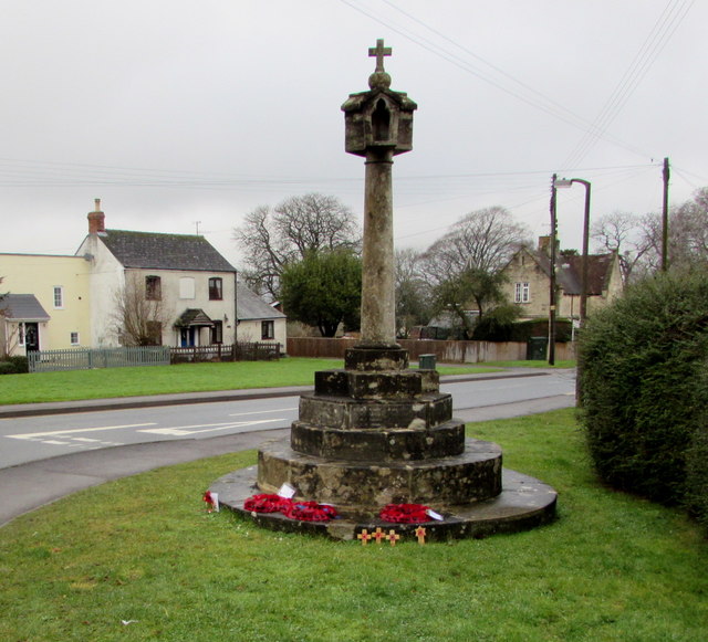
Image: © Jaggery Taken: 22 Dec 2017
The Cotswold limestone memorial, of unusually elaborate form, with a four-sided lantern head which served as a light, was erected c1920 in the middle of the road at the junction of Broad Street, Church Street and High Street. After the Second World War, the Memorial was altered to also commemorate the men of the village who lost their lives in that conflict. In 1983, to minimise the risk of damage from traffic, the Memorial was moved a short distance to its present roadside location. Grade II listed in 2016.
Images are licensed for reuse under creativecommons.org/licenses/by-sa/2.0
Image Location
Latitude
51.730165
Longitude
-2.273899