Witcombe Telephone Exchange
Introduction
The photograph on this page of Witcombe Telephone Exchange by David Hillas as part of the Geograph project.
The Geograph project started in 2005 with the aim of publishing, organising and preserving representative images for every square kilometre of Great Britain, Ireland and the Isle of Man.

There are currently over 7.5m images from over 14,400 individuals and you can help contribute to the project by visiting https://www.geograph.org.uk
Witcombe Telephone Exchange
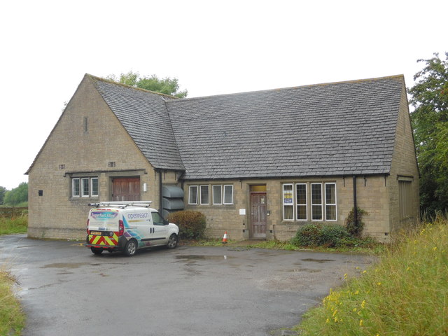
Image: © David Hillas Taken: 9 Aug 2017
Situated off Ermin Way, this TE, built of Cotswold stone, would appear to date from the GPO era and used to take the name Witcombe until recently. It has the code SSWCE and serves 2,563 residential and 113 non-residential premises in Birdlip, Brimpsfield, Brockworth, Great Witcombe, Little Witcombe and the surrounding rural area. A BT Openreach van can be seen parked in front of this TE. The numbering range of this TE is (01452) 86xxxx, the (01452) referring to the sixteen TEs in the Gloucester group, and its postcode is GL3 4SP.
Images are licensed for reuse under creativecommons.org/licenses/by-sa/2.0
Image Location


Leaflet Map data © OpenStreetMap
Latitude
51.838116
Longitude
-2.137399