Wycliffe College Chapel, Stonehouse
Introduction
The photograph on this page of Wycliffe College Chapel, Stonehouse by Jaggery as part of the Geograph project.
The Geograph project started in 2005 with the aim of publishing, organising and preserving representative images for every square kilometre of Great Britain, Ireland and the Isle of Man.

There are currently over 7.5m images from over 14,400 individuals and you can help contribute to the project by visiting https://www.geograph.org.uk
Wycliffe College Chapel, Stonehouse
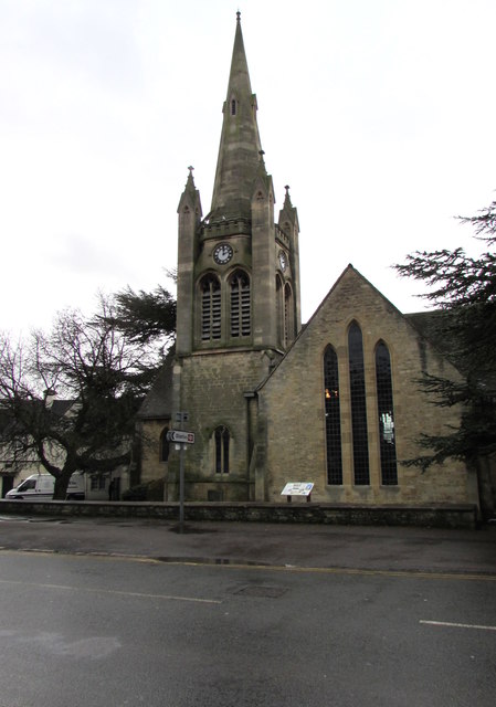
Image: © Jaggery Taken: 13 Dec 2017
Viewed across Bath Road from the corner of Burdett Road. A Stonehouse History Group information board records that in its early days, Wycliffe was closely linked to the Methodist church in Stonehouse which at that time met in an iron chapel at Ryeford. Land next to Ivy Grove was used in 1911 to build a chapel to be shared by the school and the Methodists. The clock tower and spire were added in 1921 as a memorial to the 77 Old Wycliffians who died in the Great War (now usually known as the First World War). In 1939 the chapel was transferred from the Methodist church to the school.
Images are licensed for reuse under creativecommons.org/licenses/by-sa/2.0
Image Location
Latitude
51.744175
Longitude
-2.280647