Railway bridge, Seahill, Bangor (December 2017)
Introduction
The photograph on this page of Railway bridge, Seahill, Bangor (December 2017) by Albert Bridge as part of the Geograph project.
The Geograph project started in 2005 with the aim of publishing, organising and preserving representative images for every square kilometre of Great Britain, Ireland and the Isle of Man.

There are currently over 7.5m images from over 14,400 individuals and you can help contribute to the project by visiting https://www.geograph.org.uk
Railway bridge, Seahill, Bangor (December 2017)
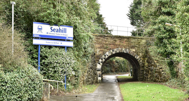
Image: © Albert Bridge Taken: 19 Dec 2017
An overbridge at the entrance to Seahill station (left). It carries the railway over a path connecting the Old Seahill Road to the Seahill Road (behind me). The path was probably once the line of the old road though I don’t know when it was abandoned.
Images are licensed for reuse under creativecommons.org/licenses/by-sa/2.0
Image Location
Latitude
54.660415
Longitude
-5.769241