Roof Structure of the Former St Michael's Church
Introduction
The photograph on this page of Roof Structure of the Former St Michael's Church by John S Turner as part of the Geograph project.
The Geograph project started in 2005 with the aim of publishing, organising and preserving representative images for every square kilometre of Great Britain, Ireland and the Isle of Man.

There are currently over 7.5m images from over 14,400 individuals and you can help contribute to the project by visiting https://www.geograph.org.uk
Roof Structure of the Former St Michael's Church
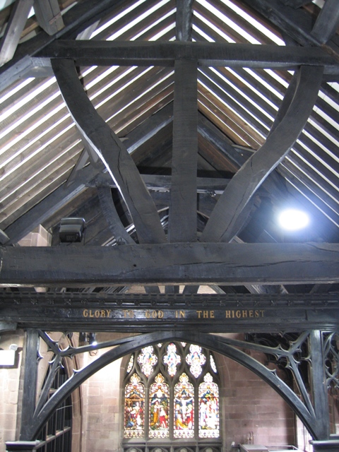
Image: © John S Turner Taken: 8 Sep 2007
The former St Michael's church, on the corner of Pepper Street and Bridge Street, became the first British Heritage Centre in 1975. An upper office level has been created in the nave, which provides, on heritage open days, a convenient viewing platform for the roof structure.
Images are licensed for reuse under creativecommons.org/licenses/by-sa/2.0
Image Location
Latitude
53.188746
Longitude
-2.890581