The Quay
Introduction
The photograph on this page of The Quay by Ian Capper as part of the Geograph project.
The Geograph project started in 2005 with the aim of publishing, organising and preserving representative images for every square kilometre of Great Britain, Ireland and the Isle of Man.

There are currently over 7.5m images from over 14,400 individuals and you can help contribute to the project by visiting https://www.geograph.org.uk
The Quay
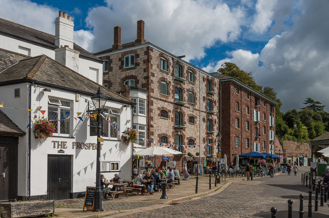
Image: © Ian Capper Taken: 15 Sep 2017
Various businesses on the quayside alongside the River Exe. On the left is The Prospect, originally the Fountain, probably dating from the early 19th Century. Grade II listed - see www.historicengland.org.uk/listing/the-list/list-entry/1223043. Beyond is King's Wharf, a pair of former warehouse buildings, now housing a range of small shops and food/drink establishments. Grade II* listed - see www.historicengland.org.uk/listing/the-list/list-entry/1223046.
Images are licensed for reuse under creativecommons.org/licenses/by-sa/2.0
Image Location
Latitude
50.718532
Longitude
-3.530594