Hoo Park Bridge
Introduction
The photograph on this page of Hoo Park Bridge by Nigel Cox as part of the Geograph project.
The Geograph project started in 2005 with the aim of publishing, organising and preserving representative images for every square kilometre of Great Britain, Ireland and the Isle of Man.

There are currently over 7.5m images from over 14,400 individuals and you can help contribute to the project by visiting https://www.geograph.org.uk
Hoo Park Bridge
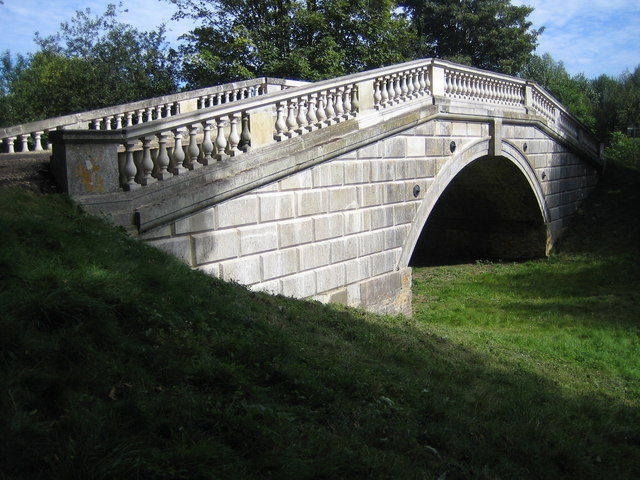
Image: © Nigel Cox Taken: 16 Sep 2007
Designed by Sir William Chambers and dating from around 1764 the bridge gave a grand entrance from the east to the Hoo Park estate. As Rob points out in Image the bridge passes over a ditch, and not, as one might expect, the River Mimram which flows anonymously under the access road to the bridge a little way to the east. The ditch is now dry and was probably part of the landscaping of the estate, rather than a naturally formed watercourse. Recently the bridge fell into such a state of serious disrepair that it was included in the Buildings at Risk Register. However maintenance works, mainly funded by a grant from English Heritage, have restored it to its original condition. The bridge is marked in Gothic text on the OS 1:25,000 scale mapping reflecting its antiquity. Update February 2020 A look now at old large scale Ordnance Survey maps not available online in 2007 shows that when the bridge was built it carried the road over the downstream end of a large impounded artificial lake forming part of the landscaping of the estate. The lake was still extant in 1922 as there is a specific water level height recorded on the map, but by the time that the 1973 edition was published the lake had disappeared, and the River Mimram was flowing under the road to the east as mentioned above.
Images are licensed for reuse under creativecommons.org/licenses/by-sa/2.0
Image Location


Leaflet Map data © OpenStreetMap
Latitude
51.860419
Longitude
-0.267538