OS benchmark - Danesford, building by Danesford Manor
Introduction
The photograph on this page of OS benchmark - Danesford, building by Danesford Manor by Richard Law as part of the Geograph project.
The Geograph project started in 2005 with the aim of publishing, organising and preserving representative images for every square kilometre of Great Britain, Ireland and the Isle of Man.

There are currently over 7.5m images from over 14,400 individuals and you can help contribute to the project by visiting https://www.geograph.org.uk
OS benchmark - Danesford, building by Danesford Manor
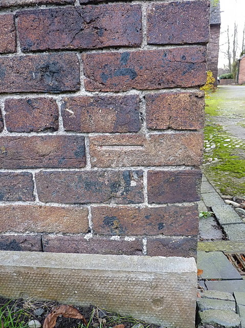
Image: © Richard Law Taken: 3 Dec 2017
An OS cutmark on a roadside building at Danesford; originally levelled, probably in 1960, at 39.865m above Ordnance Datum Newlyn.
Images are licensed for reuse under creativecommons.org/licenses/by-sa/2.0
Image Location
Latitude
52.523353
Longitude
-2.408157