Trig point of The Holmes
Introduction
The photograph on this page of Trig point of The Holmes by Trevor Littlewood as part of the Geograph project.
The Geograph project started in 2005 with the aim of publishing, organising and preserving representative images for every square kilometre of Great Britain, Ireland and the Isle of Man.

There are currently over 7.5m images from over 14,400 individuals and you can help contribute to the project by visiting https://www.geograph.org.uk
Trig point of The Holmes
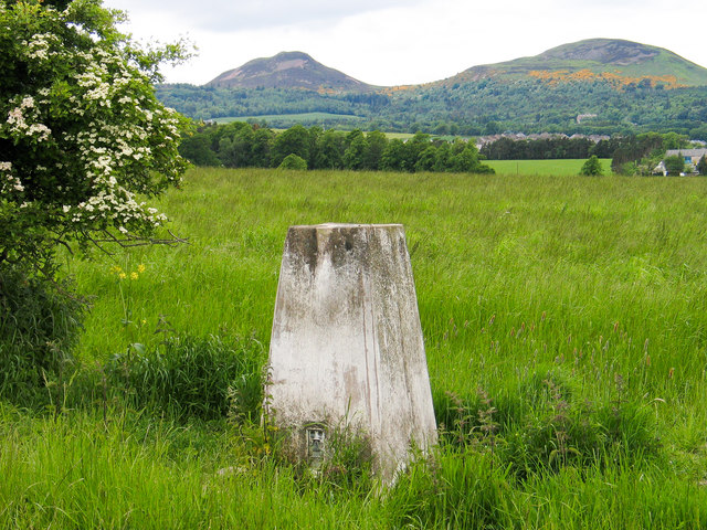
Image: © Trevor Littlewood Taken: 5 Jun 2004
The trig point known to the OS as The Holmes stands close to a field edge above the A68, close to the village of St. Boswells. Two of the Eildon Hills are in the distance.
Images are licensed for reuse under creativecommons.org/licenses/by-sa/2.0
Image Location
Latitude
55.569918
Longitude
-2.656332