
Old Milestone by the A354, south west of Winterborne Whitechurch
Introduction
The photograph on this page of Old Milestone by the A354, south west of Winterborne Whitechurch by Alan Rosevear as part of the Geograph project.
The Geograph project started in 2005 with the aim of publishing, organising and preserving representative images for every square kilometre of Great Britain, Ireland and the Isle of Man.

There are currently over 7.5m images from over 14,400 individuals and you can help contribute to the project by visiting https://www.geograph.org.uk
Old Milestone by the A354, south west of Winterborne Whitechurch
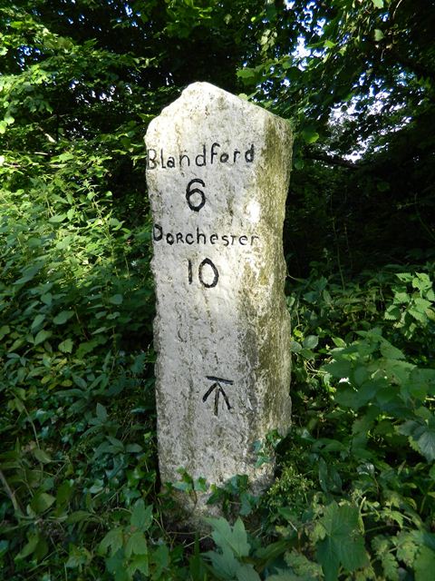
Image: © Alan Rosevear Taken: 30 Jun 2012
Carved stone post by the A354, in parish of MILBORNE ST ANDREW (NORTH DORSET District), 250m West of entrance road to Field Barn Farm, on bank amongst small trees, on South side of road. Dorset 1 (limestone), erected by the Harnham, Blandford & Dorchester turnpike trust in the 19th century. Photo from 2025 https://www.facebook.com/groups/MilestoneSociety/permalink/9240620132642188 See https://www.flickr.com/photos/tollhouses/7477983804/in/datetaken/ for reverse face. Inscription reads:- Blandford 6 Dorchester 10 Carved benchmark bottom centre of front face. Grade II Listed. List Entry Number:1324264 https://historicengland.org.uk/listing/the-list/list-entry/1324264 Milestone Society National ID: DO_DOBF10
Images are licensed for reuse under creativecommons.org/licenses/by-sa/2.0
Image Location

Latitude
50.789499
Longitude
-2.25013