Old milestone by the A390 at No Man's Land
Introduction
The photograph on this page of Old milestone by the A390 at No Man's Land by Ian Thompson as part of the Geograph project.
The Geograph project started in 2005 with the aim of publishing, organising and preserving representative images for every square kilometre of Great Britain, Ireland and the Isle of Man.

There are currently over 7.5m images from over 14,400 individuals and you can help contribute to the project by visiting https://www.geograph.org.uk
Old milestone by the A390 at No Man's Land
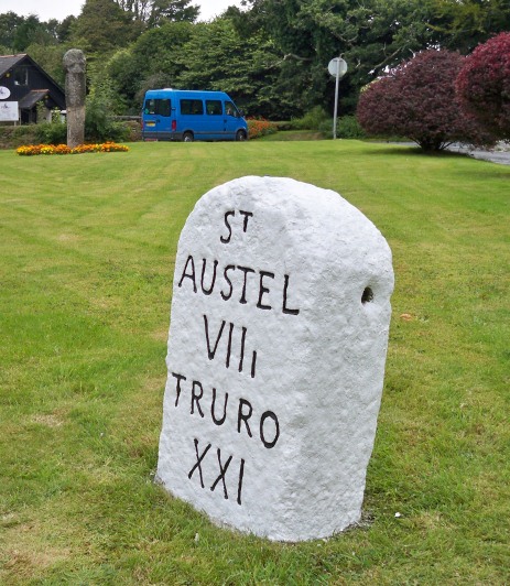
Image: © Ian Thompson Taken: Unknown
Carved stone post by the A390, in parish of LOSTWITHIEL (RESTORMEL District), Pelyn, Edgecombe Road, Crewell, on large grassed area near junction and Wayside Cross, outside cottages, on North side of road. St Austell Roman stone, erected by the St Austell & Lostwithiel turnpike trust in the 18th century. Inscription reads:- ST AUSTEL VIIi TRURO XXI Carved benchmark on base. Grade II Listed. List Entry Number:1327330 https://historicengland.org.uk/listing/the-list/list-entry/1327330 Milestone Society National ID: CW_TOSA21
Images are licensed for reuse under creativecommons.org/licenses/by-sa/2.0
Image Location
Latitude
50.400713
Longitude
-4.689584