Old Milestone by the A390 in Sticker
Introduction
The photograph on this page of Old Milestone by the A390 in Sticker by Ian Thompson as part of the Geograph project.
The Geograph project started in 2005 with the aim of publishing, organising and preserving representative images for every square kilometre of Great Britain, Ireland and the Isle of Man.

There are currently over 7.5m images from over 14,400 individuals and you can help contribute to the project by visiting https://www.geograph.org.uk
Old Milestone by the A390 in Sticker
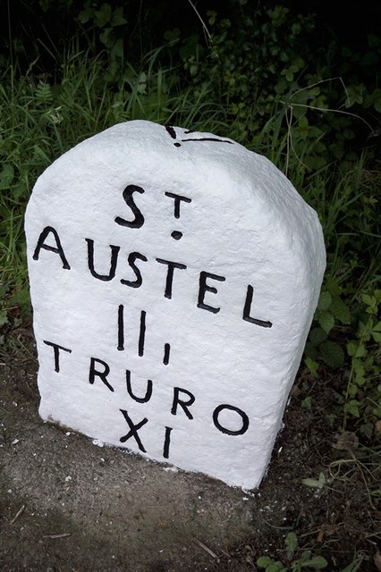
Image: © Ian Thompson Taken: 1 Jun 1996
Carved stone post by the A390, in parish of ST MEWAN (RESTORMEL District), Sticker; opposite "Mors Hus", by the road, on North side of road. St Austell Roman stone, erected by the St Austell & Lostwithiel turnpike trust in the 18th century. Inscription reads:- ST AUSTEL IIi TRURO XI Carved benchmark and rivet on top. Grade II Listed. List Entry Number:1144015 https://historicengland.org.uk/listing/the-list/list-entry/1144015 Milestone Society National ID: CW_TOSA11.
Images are licensed for reuse under creativecommons.org/licenses/by-sa/2.0
Image Location
Latitude
50.317414
Longitude
-4.838373