Old Milestone by the A39, north east of Hal's Grave
Introduction
The photograph on this page of Old Milestone by the A39, north east of Hal's Grave by Ian Thompson as part of the Geograph project.
The Geograph project started in 2005 with the aim of publishing, organising and preserving representative images for every square kilometre of Great Britain, Ireland and the Isle of Man.

There are currently over 7.5m images from over 14,400 individuals and you can help contribute to the project by visiting https://www.geograph.org.uk
Old Milestone by the A39, north east of Hal's Grave
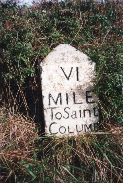
Image: © Ian Thompson Taken: 10 Dec 2017
Carved stone post by the A39, in parish of ST BREOCK (NORTH CORNWALL District), 300m South West of Whitecross, South of Wadebridge Showground, on narrow bend, on North side of road. St Columb stone, erected by the Camelford, Wadebridge & St Columb turnpike trust in the 18th century. Inscription reads:- VI MILE To Saint COLUMB Grade II Listed. List Entry Number:1143060 https://historicengland.org.uk/listing/the-list/list-entry/1143060 Milestone Society National ID: CW_SCWB06.
Images are licensed for reuse under creativecommons.org/licenses/by-sa/2.0
Image Location
Latitude
50.510878
Longitude
-4.875922