Old Milestone by the B3254 near West Curry
Introduction
The photograph on this page of Old Milestone by the B3254 near West Curry by Ian Thompson as part of the Geograph project.
The Geograph project started in 2005 with the aim of publishing, organising and preserving representative images for every square kilometre of Great Britain, Ireland and the Isle of Man.

There are currently over 7.5m images from over 14,400 individuals and you can help contribute to the project by visiting https://www.geograph.org.uk
Old Milestone by the B3254 near West Curry
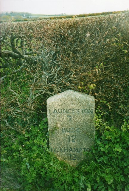
Image: © Ian Thompson Taken: 1 May 2002
Carved stone post by the B3254, in parish of BOYTON (NORTH CORNWALL District), Parkhurst, West Curry, against hedge on bend, on East side of road. Kilkhampton County stone, erected by the Local Highways Board in the 19th century. Inscription reads:- LAUNCESTON 7 BUDE 12 KILKHAMPTON 12 Milestone Society National ID: CW_KHLA12.
Images are licensed for reuse under creativecommons.org/licenses/by-sa/2.0
Image Location
Latitude
50.723222
Longitude
-4.432237