Old Milestone by the B3303, south of Camborne
Introduction
The photograph on this page of Old Milestone by the B3303, south of Camborne by Ian Thompson as part of the Geograph project.
The Geograph project started in 2005 with the aim of publishing, organising and preserving representative images for every square kilometre of Great Britain, Ireland and the Isle of Man.

There are currently over 7.5m images from over 14,400 individuals and you can help contribute to the project by visiting https://www.geograph.org.uk
Old Milestone by the B3303, south of Camborne
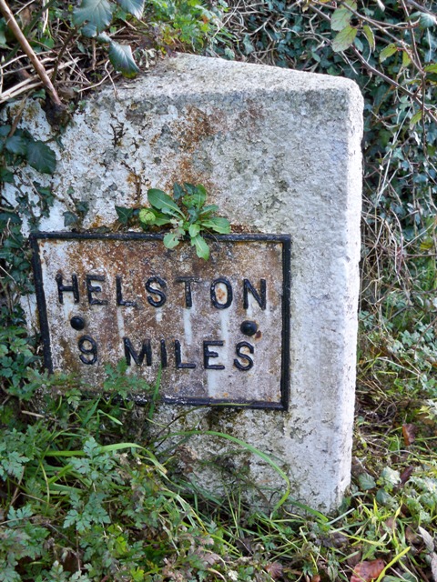
Image: © Ian Thompson Taken: 10 Dec 2017
Metal plates attached to stone post by the B3303, in parish of CAMBORNE (KERRIER District), Gear, North of turning to Treslothan and Troon, set in bank, on East side of road. Erected by the Local Highways Board in the 19th century. Inscription reads:- : HELSTON / 9 MILES : : CAMBORNE / 1 (plate missing, writing cut in stone) : Milestone Society National ID: CW_HLCA09.
Images are licensed for reuse under creativecommons.org/licenses/by-sa/2.0
Image Location
Latitude
50.204818
Longitude
-5.303527