Old Milestone by the A595 in Gosforth
Introduction
The photograph on this page of Old Milestone by the A595 in Gosforth by CF Smith as part of the Geograph project.
The Geograph project started in 2005 with the aim of publishing, organising and preserving representative images for every square kilometre of Great Britain, Ireland and the Isle of Man.

There are currently over 7.5m images from over 14,400 individuals and you can help contribute to the project by visiting https://www.geograph.org.uk
Old Milestone by the A595 in Gosforth
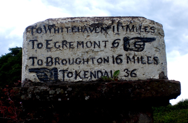
Image: © CF Smith Taken: 12 Jul 2010
Carved stone post by the A595, in parish of GOSFORTH (COPELAND District), junction of the A595 and the road North of the village; North West of High School House, on wall of school, on East side of road. Whitehaven plate stone, erected by the Whitehaven turnpike trust in the 19th century. Inscription reads:- : TO WHITEHAVEN 11 MILES / TO EGREMONT 6 {hand} / TO BROUGHTON 16 MILES / {hand} TO KENDAL 36 : : TO WHITEHAVEN 11 MILES / {hand} TO EGREMONT 6 / TO RAVENGLASS 5 MILES / TO ULVERSTON 31 MILES {hand} : Grade II Listed. List Entry Number: 1336057 https://historicengland.org.uk/listing/the-list/list-entry/1336057 Milestone Society National ID: CU_XGOS
Images are licensed for reuse under creativecommons.org/licenses/by-sa/2.0
Image Location
Latitude
54.420194
Longitude
-3.443838