Old Milestone by the B5291, west of Embleton
Introduction
The photograph on this page of Old Milestone by the B5291, west of Embleton by CF Smith as part of the Geograph project.
The Geograph project started in 2005 with the aim of publishing, organising and preserving representative images for every square kilometre of Great Britain, Ireland and the Isle of Man.

There are currently over 7.5m images from over 14,400 individuals and you can help contribute to the project by visiting https://www.geograph.org.uk
Old Milestone by the B5291, west of Embleton
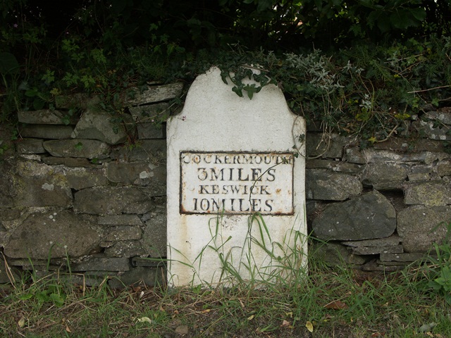
Image: © CF Smith Taken: 15 Aug 2005
Metal plate attached to stone post by the B5291, in parish of EMBLETON (ALLERDALE District), West end of village, opposite Blue Bell Inn, on grass verge against wall, on North side of road. Cockermouth plate, erected by the Keswick turnpike trust in the 19th century. Inscription reads:- COCKERMOUTH 3 MILES KESWICK 10 MILES Grade II Listed. List Entry Number: 1145180 https://historicengland.org.uk/listing/the-list/list-entry/1145180 Milestone Society National ID: CU_CMKW03.
Images are licensed for reuse under creativecommons.org/licenses/by-sa/2.0
Image Location
Latitude
54.661852
Longitude
-3.292277