Old Milestone by the B6318
Introduction
The photograph on this page of Old Milestone by the B6318 by CF Smith as part of the Geograph project.
The Geograph project started in 2005 with the aim of publishing, organising and preserving representative images for every square kilometre of Great Britain, Ireland and the Isle of Man.

There are currently over 7.5m images from over 14,400 individuals and you can help contribute to the project by visiting https://www.geograph.org.uk
Old Milestone by the B6318
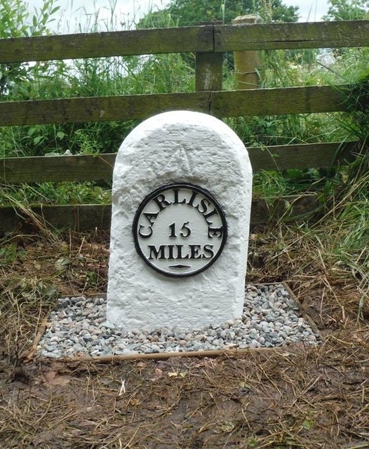
Image: © CF Smith Taken: 21 Feb 2011
Metal plate attached to stone post by the B6318, in parish of NICHOLFOREST (CARLISLE District), South East of Penton House, junction with UC road to Watleyhirst, on the verge, on East side of road. Carlisle round iron plate, erected by the Longtown, Snab & Haithwaite Bridge turnpike trust in the 19th century. Inscription reads:- CARLISLE 15 MILES - Carved benchmark on mid top front. Milestone Society National ID: CU_CLHW15.
Images are licensed for reuse under creativecommons.org/licenses/by-sa/2.0
Image Location
Latitude
55.082781
Longitude
-2.885402