Old Milestone by the A596, Low Whinnow
Introduction
The photograph on this page of Old Milestone by the A596, Low Whinnow by CF Smith as part of the Geograph project.
The Geograph project started in 2005 with the aim of publishing, organising and preserving representative images for every square kilometre of Great Britain, Ireland and the Isle of Man.

There are currently over 7.5m images from over 14,400 individuals and you can help contribute to the project by visiting https://www.geograph.org.uk
Old Milestone by the A596, Low Whinnow
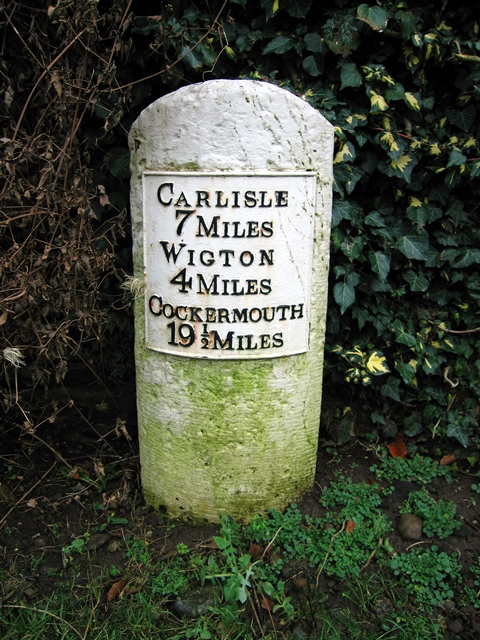
Image: © CF Smith Taken: 30 Dec 2008
Metal plate attached to stone post by the A596, in parish of THURSBY (ALLERDALE District), Whinnow, Private farmhouse, on South side of road. Carlisle red stone and curved plate, erected by the Cockermouth & Carlisle turnpike trust in the 19th century. Inscription reads:- CARLISLE 7 MILES WIGTON 4 MILE COCKERMOUTH 19½ MILES Carved benchmark. Milestone Society National ID: CU_CLCMa07.
Images are licensed for reuse under creativecommons.org/licenses/by-sa/2.0
Image Location
Latitude
54.847945
Longitude
-3.085596