Old Milepost by the A525, Woore Road, east of Buerton
Introduction
The photograph on this page of Old Milepost by the A525, Woore Road, east of Buerton by J Higgins as part of the Geograph project.
The Geograph project started in 2005 with the aim of publishing, organising and preserving representative images for every square kilometre of Great Britain, Ireland and the Isle of Man.

There are currently over 7.5m images from over 14,400 individuals and you can help contribute to the project by visiting https://www.geograph.org.uk
Old Milepost by the A525, Woore Road, east of Buerton
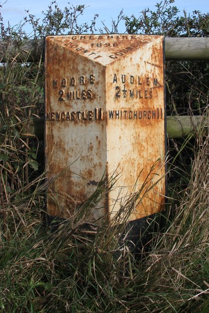
Image: © J Higgins Taken: 1 Mar 2004
Cast iron post by the A525, in parish of Buerton (Crewe and Nantwich District), West of entrance to The Grange, on the verge in front of fence, on North side of road. Cast iron CCC1896, erected by the County Council in the 19th century. Inscription reads:- : WOORE / 2 MILES / NEWCASTLE 11 : : CHESHIRE / 1896 / COUNTY COUNCIL : : AUDLEM / 2½ MILES / WHITCHURCH 11 : Maker:- : W H SMITH & CO / MAKERS / WHITCHURCH : Milestone Society National ID: CH_NWWC11
Images are licensed for reuse under creativecommons.org/licenses/by-sa/2.0
Image Location
Latitude
52.98407
Longitude
-2.450471