Old Milepost by the A50 in Nether Knutsford
Introduction
The photograph on this page of Old Milepost by the A50 in Nether Knutsford by M Faherty as part of the Geograph project.
The Geograph project started in 2005 with the aim of publishing, organising and preserving representative images for every square kilometre of Great Britain, Ireland and the Isle of Man.

There are currently over 7.5m images from over 14,400 individuals and you can help contribute to the project by visiting https://www.geograph.org.uk
Old Milepost by the A50 in Nether Knutsford
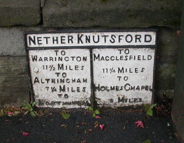
Image: © M Faherty Taken: 16 May 2009
Cast iron plate by the A50, in parish of Knutsford (Macclesfield District), Toft Road junction with Church Hill, fixed to churchyard wall, on East side of road. Erected by the Cranage & Warrington turnpike trust in the 19th century. Inscription reads:- : TO / WARRINGTON / 11½ MILES / TO / ALTRINCHAM / 7¼ MILES / TO / NORTHWICH / (...) : : NETHER KNUTSFORD : : TO / MACCLESFIELD / 11¼ MILES / TO / HOLMES CHAPEL / 8 MILES : Milestone Society National ID: CH_KFWA00
Images are licensed for reuse under creativecommons.org/licenses/by-sa/2.0
Image Location
Latitude
53.302906
Longitude
-2.373961