Old Milepost by the A50, Knutsford Road, Cranage
Introduction
The photograph on this page of Old Milepost by the A50, Knutsford Road, Cranage by John V Nicholls as part of the Geograph project.
The Geograph project started in 2005 with the aim of publishing, organising and preserving representative images for every square kilometre of Great Britain, Ireland and the Isle of Man.

There are currently over 7.5m images from over 14,400 individuals and you can help contribute to the project by visiting https://www.geograph.org.uk
Old Milepost by the A50, Knutsford Road, Cranage
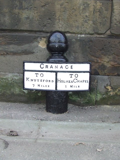
Image: © John V Nicholls Taken: 22 Mar 2009
Cast iron post by the A50, in parish of Cranage (Congleton District), Knutsford Road; 5m South of Byley Lane junction, on narrow ledge under stone wall, on West side of road. Old acorn open book, erected by the Cranage & Warrington turnpike trust in the 19th century. Inscription reads:- : TO / KNUTSFORD / 7 MILES : : CRANAGE : : TO / HOLMES CHAPEL / 1 MILE : Grade II listed. List Entry Number: 1231687 https://historicengland.org.uk/listing/the-list/list-entry/1231687 Milestone Society National ID: CH_KFHC07
Images are licensed for reuse under creativecommons.org/licenses/by-sa/2.0
Image Location
Latitude
53.213515
Longitude
-2.372852