Old Milestone in High Street, Tarporley
Introduction
The photograph on this page of Old Milestone in High Street, Tarporley by Gillian Oakes as part of the Geograph project.
The Geograph project started in 2005 with the aim of publishing, organising and preserving representative images for every square kilometre of Great Britain, Ireland and the Isle of Man.

There are currently over 7.5m images from over 14,400 individuals and you can help contribute to the project by visiting https://www.geograph.org.uk
Old Milestone in High Street, Tarporley
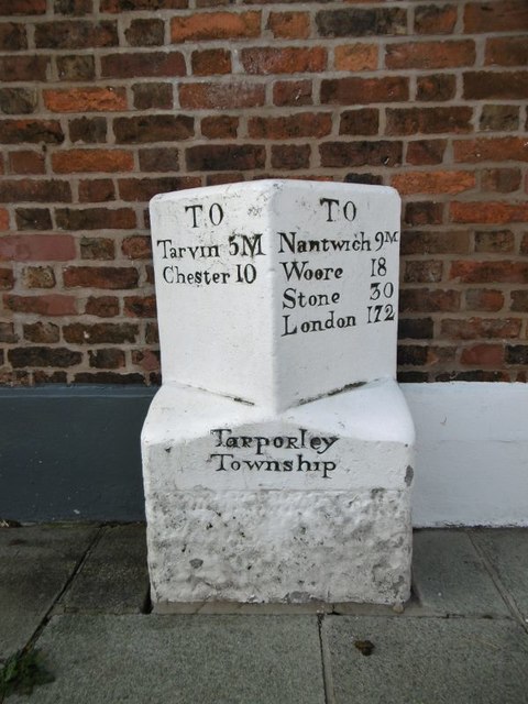
Image: © Gillian Oakes Taken: 1 Jan 2003
Carved stone post by the UC road (was A51), in parish of Tarporley (Vale Royal District), High Street, in pavement, back to brick wall of building, on West side of road. Chester Road stone, erected by the Nantwich & Woore turnpike trust in the 19th century. Inscription reads:- : TO / Tarvin 5M / Chester 10 : : TaRpoRley / Township : : TO / Nantwich 9M / Woore 18 / Stone 30 / London 172 : Grade II listed. List Entry Number: 1136670 https://historicengland.org.uk/listing/the-list/list-entry/1136670 Milestone Society National ID: CH_CHNW10
Images are licensed for reuse under creativecommons.org/licenses/by-sa/2.0
Image Location
Latitude
53.159374
Longitude
-2.668849