Old Milestone by the former A5, south east of Fenny Stratford
Introduction
The photograph on this page of Old Milestone by the former A5, south east of Fenny Stratford by A Rosevear & J Higgins as part of the Geograph project.
The Geograph project started in 2005 with the aim of publishing, organising and preserving representative images for every square kilometre of Great Britain, Ireland and the Isle of Man.

There are currently over 7.5m images from over 14,400 individuals and you can help contribute to the project by visiting https://www.geograph.org.uk
Old Milestone by the former A5, south east of Fenny Stratford
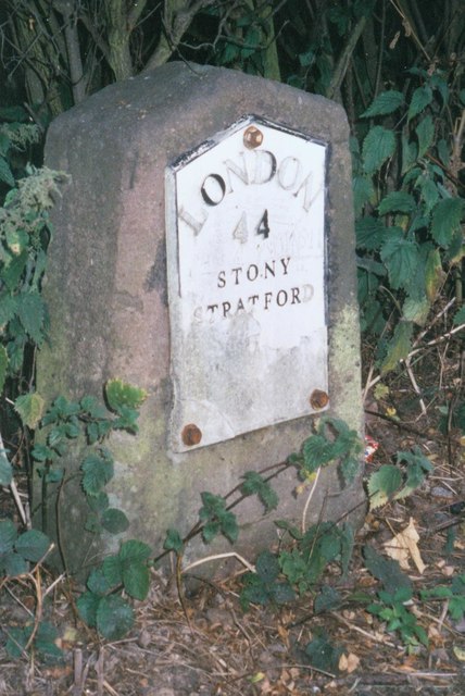
Image: © A Rosevear & J Higgins Taken: 11 Jul 2003
Metal plate attached to stone post by the UC road (was A5), in parish of Bletchley (Milton Keynes District), Watling Street; between river bridge and canal bridge, opposite Attic Restaurant, in hedge, behind footpath, on South side of road. Milton Keynes iron plate, erected by the Holyhead Road (Hockliffe Division) turnpike trust in the 19th century. Inscription reads:- LONDON 44 STONY STRATFORD 7 Carved benchmark on lower front face. Milestone Society National ID: BU_LH44
Images are licensed for reuse under creativecommons.org/licenses/by-sa/2.0
Image Location
Latitude
51.997061
Longitude
-0.712442