Old Milestone on the A413, south of Aylesbury
Introduction
The photograph on this page of Old Milestone on the A413, south of Aylesbury by A Rosevear & J Higgins as part of the Geograph project.
The Geograph project started in 2005 with the aim of publishing, organising and preserving representative images for every square kilometre of Great Britain, Ireland and the Isle of Man.

There are currently over 7.5m images from over 14,400 individuals and you can help contribute to the project by visiting https://www.geograph.org.uk
Old Milestone on the A413, south of Aylesbury
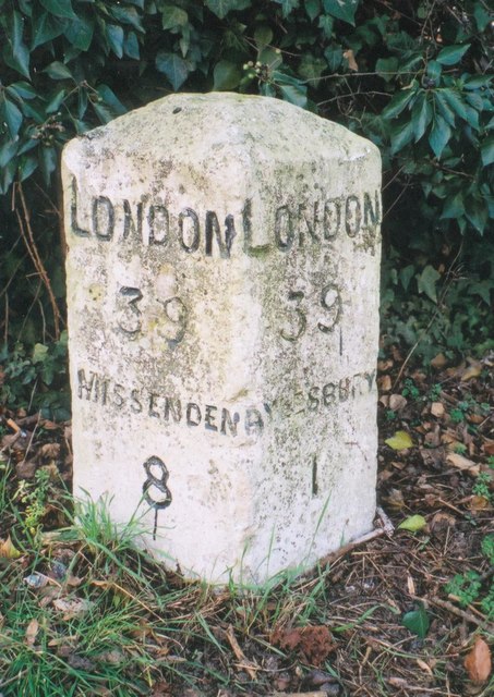
Image: © A Rosevear & J Higgins Taken: 25 Feb 2003
Carved stone post by the A413, in parish of Aylesbury (Aylesbury Vale District), Wendover Road; Bedgrove, by bus stop shelter, East of junction with Elm Farm Road, near pedestrian crossing traffic lights, between slab path and hedge, on West side of road. Aylesbury square, erected by the Wendover & Buckingham turnpike trust in the 18th century. Inscription reads:- : LONDON / 39 / MISSENDEN / 8 : : LONDON / 39 / AYLESBURY / 1 : Buckinghamshire HER. HER Number: 1418300000 https://www.heritagegateway.org.uk/Gateway/Results_Single.aspx?uid=MBC26566&resourceID=1024 Milestone Society National ID: BU_LC39
Images are licensed for reuse under creativecommons.org/licenses/by-sa/2.0
Image Location
Latitude
51.80323
Longitude
-0.793519