Old Milestone by the A413, south of Amersham
Introduction
The photograph on this page of Old Milestone by the A413, south of Amersham by A Rosevear & J Higgins as part of the Geograph project.
The Geograph project started in 2005 with the aim of publishing, organising and preserving representative images for every square kilometre of Great Britain, Ireland and the Isle of Man.

There are currently over 7.5m images from over 14,400 individuals and you can help contribute to the project by visiting https://www.geograph.org.uk
Old Milestone by the A413, south of Amersham
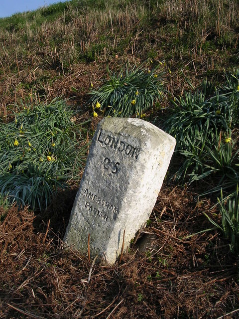
Image: © A Rosevear & J Higgins Taken: 1 Mar 2004
Carved stone post by the A413, in parish of Amersham (Chiltern District), London Road East; South East of Bury End Roundabout, beyond houses, 25m before Gas Compound, at base of grass bank on grass verge behind footpath, surrounded by planted daffodils (covered in bracken in summer), on East side of road. Amersham limestone square, erected by the Wendover & Oak Lane turnpike trust in the 18th century. Inscription reads:- LONDON 25 AMERSHAM PARISH Buckinghamshire HER. HER Number: 1352200000 https://www.heritagegateway.org.uk/Gateway/Results_Single.aspx?uid=MBC25899&resourceID=1024 Milestone Society National ID: BU_LC25
Images are licensed for reuse under creativecommons.org/licenses/by-sa/2.0
Image Location
Latitude
51.661573
Longitude
-0.596446