Old Milestone by the A338, north of East Hanney
Introduction
The photograph on this page of Old Milestone by the A338, north of East Hanney by A Rosevear as part of the Geograph project.
The Geograph project started in 2005 with the aim of publishing, organising and preserving representative images for every square kilometre of Great Britain, Ireland and the Isle of Man.

There are currently over 7.5m images from over 14,400 individuals and you can help contribute to the project by visiting https://www.geograph.org.uk
Old Milestone by the A338, north of East Hanney
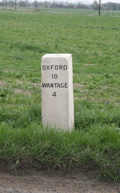
Image: © A Rosevear Taken: 3 Aug 2004
Carved stone post by the A338, in parish of East Hanney (Vale of White Horse District), Oxford Road; on straight, North of Hanney, 30m from lane to a barn, on grass verge by fence, on East side of road. Vale square, erected by the Besselsleigh turnpike trust in the 19th century. Inscription reads:- OXFORD 10 WANTAGE 4 Carved benchmark and rivet on top. Grade II listed. List Entry Number: 1199482 https://historicengland.org.uk/listing/the-list/list-entry/1199482 Milestone Society National ID: BE_WABL04
Images are licensed for reuse under creativecommons.org/licenses/by-sa/2.0
Image Location
Latitude
51.639377
Longitude
-1.390191