Old Milestone by the A420, south of Cumnor
Introduction
The photograph on this page of Old Milestone by the A420, south of Cumnor by A Rosevear as part of the Geograph project.
The Geograph project started in 2005 with the aim of publishing, organising and preserving representative images for every square kilometre of Great Britain, Ireland and the Isle of Man.

There are currently over 7.5m images from over 14,400 individuals and you can help contribute to the project by visiting https://www.geograph.org.uk
Old Milestone by the A420, south of Cumnor
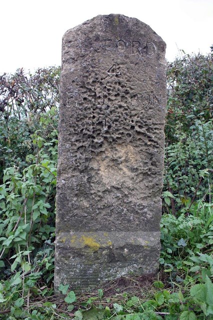
Image: © A Rosevear Taken: 24 Sep 2001
Carved stone post by the A420, in parish of Cumnor (Vale of White Horse District), Faringdon Road; West of Bradley Farm, behind pavement on grass verge by ditch, on West side of road. Fyfield tombstone and iron plate, erected by the Botley & Newland turnpike trust in the 19th century. Inscription reads:- (OX)FORD 4 FAR(ING)DON 13 There was a benchmark on plinth but eroded. Grade II listed. List Entry Number: 1181844 https://historicengland.org.uk/listing/the-list/list-entry/1181844 Milestone Society National ID: BE_OXFA04
Images are licensed for reuse under creativecommons.org/licenses/by-sa/2.0
Image Location
Latitude
51.721501
Longitude
-1.331688