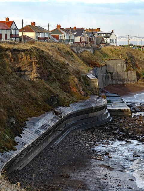
Coastal defences, Collywell Bay
Introduction
The photograph on this page of Coastal defences, Collywell Bay by Andrew Curtis as part of the Geograph project.
The Geograph project started in 2005 with the aim of publishing, organising and preserving representative images for every square kilometre of Great Britain, Ireland and the Isle of Man.
There are currently over 7.5m images from over 14,400 individuals and you can help contribute to the project by visiting https://www.geograph.org.uk

Image: © Andrew Curtis Taken: 10 Dec 2017
See another photo for a brief discussion of the geology: Image There is a good disscussion about erosion of this coastline, including the measures taken to protect the cliff face below the houses on Collywell Bay Road, in Chapter 8, 'Changing Coastal Environments' in Changing Environments by Susan Bermingham (2000). The most recent sea defences comprising large concrete slabs attached to the cliff face at the northern end of the bay were completed in 1981. The older, cliff-base, defenses in the foreground have brought about an accelerated rate of sand removal from the natural protection afforded by the beach of Collywell Sands which used to extend below the cliffs. Undercutting of the defenses is now taking place as a result of increased wave energy. The movement west of the mean high water mark is clearly demonstrated by comparison of old maps.

