Old Milestone, south of Faringdon
Introduction
The photograph on this page of Old Milestone, south of Faringdon by A Rosevear as part of the Geograph project.
The Geograph project started in 2005 with the aim of publishing, organising and preserving representative images for every square kilometre of Great Britain, Ireland and the Isle of Man.

There are currently over 7.5m images from over 14,400 individuals and you can help contribute to the project by visiting https://www.geograph.org.uk
Old Milestone, south of Faringdon
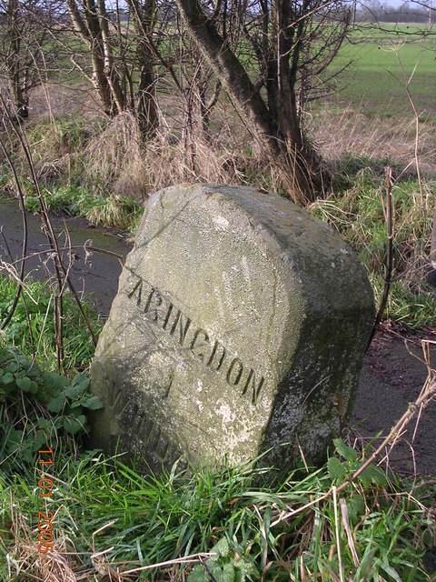
Image: © A Rosevear Taken: 16 Sep 2001
Carved stone post by the UC road (was A420), in parish of Little Coxwell (Vale of White Horse District), Coxwell Road; West of outskirts of Faringdon, 100yds North of Steeds Farm Gate, on grass verge in front of footpath, on West side of road. Faringdon tombstone erected by the Faringdon to Acton Turville (2nd District) turnpike trust in the 19th century. Inscription reads:- (F)ARINGDON 1 (S)WINDON 11 Oxfordshire HER. HER Number: 10122 https://www.heritagegateway.org.uk/Gateway/Results_Single.aspx?uid=MOX10178&resourceID=1033 Milestone Society National ID: BE_FASN01
Images are licensed for reuse under creativecommons.org/licenses/by-sa/2.0
Image Location
Latitude
51.64637
Longitude
-1.595729