Nottingham station, west end 1992
Introduction
The photograph on this page of Nottingham station, west end 1992 by Ben Brooksbank as part of the Geograph project.
The Geograph project started in 2005 with the aim of publishing, organising and preserving representative images for every square kilometre of Great Britain, Ireland and the Isle of Man.

There are currently over 7.5m images from over 14,400 individuals and you can help contribute to the project by visiting https://www.geograph.org.uk
Nottingham station, west end 1992
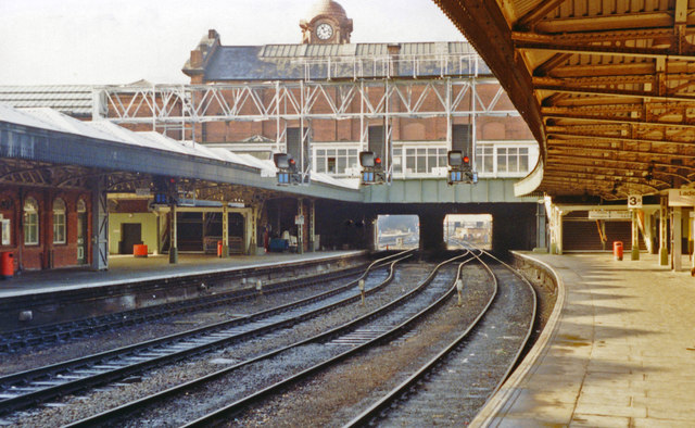
Image: © Ben Brooksbank Taken: 26 Jan 1992
Called 'Nottingham City' until 25/9/50, then Nottingham Midland 18/6/51- 5/5/69, the station has been recently (2013) thoroughly rebuilt. This view is west on the then main eastbound platform 3, towards Derby, Trent, Chesterfield, Sheffield and the North, also Mansfield, Worksop etc. Running in the opposite direction had been the main line to the South via Melton Mowbray, which closed 1/5/67, leaving only the line to Lincoln. From the west end, trains also ran to Mansfield and Worksop until 12/10/64, to be restored as the Robin Hood Line in stages from 8/5/93 to 6/98.
Images are licensed for reuse under creativecommons.org/licenses/by-sa/2.0
Image Location
Latitude
52.946824
Longitude
-1.143038