Former railway route, Cardiff Road, Newport
Introduction
The photograph on this page of Former railway route, Cardiff Road, Newport by Jaggery as part of the Geograph project.
The Geograph project started in 2005 with the aim of publishing, organising and preserving representative images for every square kilometre of Great Britain, Ireland and the Isle of Man.

There are currently over 7.5m images from over 14,400 individuals and you can help contribute to the project by visiting https://www.geograph.org.uk
Former railway route, Cardiff Road, Newport
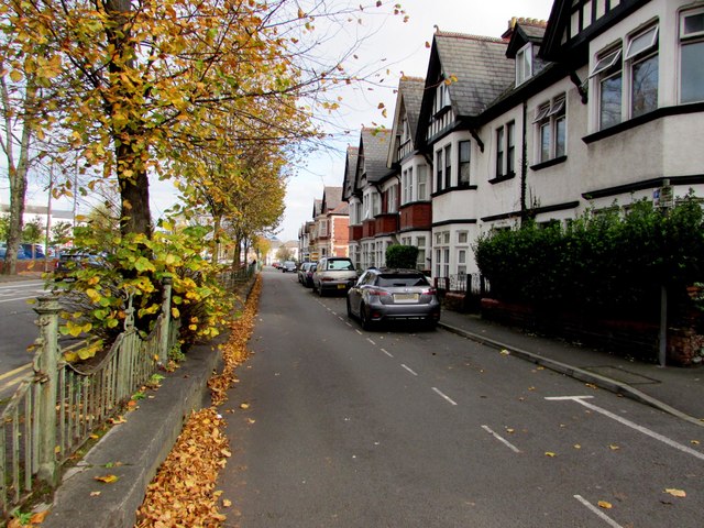
Image: © Jaggery Taken: 29 Oct 2017
There used to be an extensive network of railway lines in the lower, flatter part of Newport. One such location was this part of Cardiff Road, set about a metre below the level of the road on the left. Railings, located where the pavement is now, separated the houses from the two-track railway line.
Images are licensed for reuse under creativecommons.org/licenses/by-sa/2.0
Image Location
Latitude
51.579155
Longitude
-2.99658