The Scrape, Quarry Lane Reserve, Mansfield, Notts.
Introduction
The photograph on this page of The Scrape, Quarry Lane Reserve, Mansfield, Notts. by David Hallam-Jones as part of the Geograph project.
The Geograph project started in 2005 with the aim of publishing, organising and preserving representative images for every square kilometre of Great Britain, Ireland and the Isle of Man.

There are currently over 7.5m images from over 14,400 individuals and you can help contribute to the project by visiting https://www.geograph.org.uk
The Scrape, Quarry Lane Reserve, Mansfield, Notts.
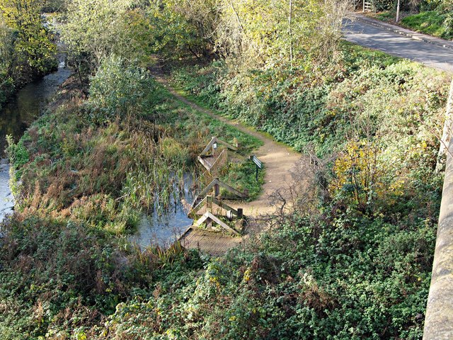
Image: © David Hallam-Jones Taken: 19 Nov 2017
"The Scrape" wildlife area. In 2004 this area, adjoining the River Maun, was dredged and redeveloped to provide a pond dipping area for local children. This photo is taken looking down from the Grade II-listed Drury Dam Viaduct. The viaduct It was restored in 1989 and now forms part of the town’s Maun trail.
Images are licensed for reuse under creativecommons.org/licenses/by-sa/2.0
Image Location
Latitude
53.135499
Longitude
-1.206105