Keevil houses [3]
Introduction
The photograph on this page of Keevil houses [3] by Michael Dibb as part of the Geograph project.
The Geograph project started in 2005 with the aim of publishing, organising and preserving representative images for every square kilometre of Great Britain, Ireland and the Isle of Man.

There are currently over 7.5m images from over 14,400 individuals and you can help contribute to the project by visiting https://www.geograph.org.uk
Keevil houses [3]
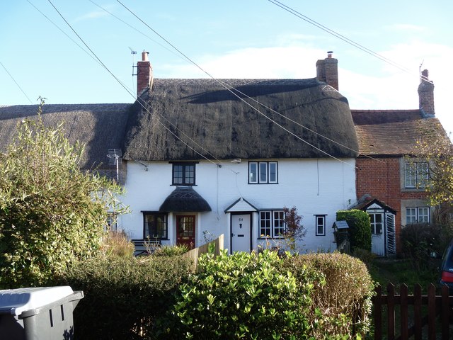
Image: © Michael Dibb Taken: 5 Nov 2017
The village has many old and interesting houses. Numbers 52 and 53 Martins Road are timber framed row houses built circa 1700. Listed, grade II, with details at: https://www.historicengland.org.uk/listing/the-list/list-entry/1262470 Number 54 (to the right) is also listed for group value with details at: https://www.historicengland.org.uk/listing/the-list/list-entry/1262539
Images are licensed for reuse under creativecommons.org/licenses/by-sa/2.0
Image Location
Latitude
51.320781
Longitude
-2.112454