
Priory Row, Priory Place and Swanswell
Introduction
The photograph on this page of Priory Row, Priory Place and Swanswell by E Gammie as part of the Geograph project.
The Geograph project started in 2005 with the aim of publishing, organising and preserving representative images for every square kilometre of Great Britain, Ireland and the Isle of Man.

There are currently over 7.5m images from over 14,400 individuals and you can help contribute to the project by visiting https://www.geograph.org.uk
Priory Row, Priory Place and Swanswell
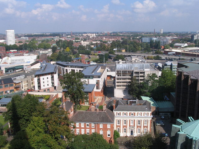
Image: © E Gammie Taken: 13 Sep 2007
From the tower of St Michael's cathedral church. Foreground: Part of the Cathedral. Georgian houses in Priory Row (nos. 9-11). No. 11, the Dean's House has white, fluted Ionic pilasters on its frontage. These houses are positioned on the crossing and chancel of the 12th century St Mary's Cathedral, lost after the Dissolution. To the left, behind the trees, is the Priory Visitor Centre, within which can be seen the remains of the Priory undercroft and some of the items excavated from the site. The white buildings are in Priory Place. To their left the white roof of the Coventry Transport Museum can be seen. The trees within the ring road are in Lady Herberts Garden. Beyond the road is Swanswell pool and park, next to which are the grey buildings of the new City College. The tower block to the left, middle distance is William Batchelor residential block by the canal basin. The white block just visible on the centre horizon is the Ricoh Arena on the old Foleshill gas works site. A 1975 view in this direction: http://www.geograph.org.uk/photo/560211
Images are licensed for reuse under creativecommons.org/licenses/by-sa/2.0
Image Location

Latitude
52.409239
Longitude
-1.507781