Lyminge: former station, now public library, 2010
Introduction
The photograph on this page of Lyminge: former station, now public library, 2010 by Ben Brooksbank as part of the Geograph project.
The Geograph project started in 2005 with the aim of publishing, organising and preserving representative images for every square kilometre of Great Britain, Ireland and the Isle of Man.

There are currently over 7.5m images from over 14,400 individuals and you can help contribute to the project by visiting https://www.geograph.org.uk
Lyminge: former station, now public library, 2010
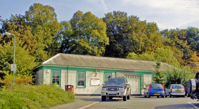
Image: © Ben Brooksbank Taken: 22 Sep 2010
View east: Canterbury left, Shorncliffe and Folkestone right: originally on the SE&CR Elham Valley (Canterbury West - Shorncliffe) branch, it was closed to passengers on 2/12/40, when it was taken over by the Army until 3/44 - although civilian passengers from/to Shorncliffe were accepted until 3/5/43. Goods traffic - notably the massive 18 in. 'Boche-Buster', continued until the line was closed completely 1/10/47. (See Image for precisely the same view in winter).
Images are licensed for reuse under creativecommons.org/licenses/by-sa/2.0
Image Location
Latitude
51.127053
Longitude
1.093545