River Neet
Introduction
The photograph on this page of River Neet by Ian Capper as part of the Geograph project.
The Geograph project started in 2005 with the aim of publishing, organising and preserving representative images for every square kilometre of Great Britain, Ireland and the Isle of Man.

There are currently over 7.5m images from over 14,400 individuals and you can help contribute to the project by visiting https://www.geograph.org.uk
River Neet
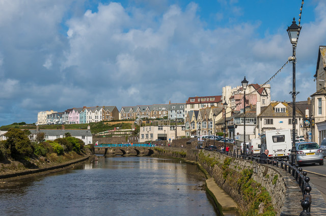
Image: © Ian Capper Taken: 12 Sep 2017
The River Neet with the Strand running alongside it on the right. Crossing the river in the background is Nanny Moore's Bridge, with the terraces of Summerleaze Crescent beyond.
Images are licensed for reuse under creativecommons.org/licenses/by-sa/2.0
Image Location
Latitude
50.829531
Longitude
-4.545693