
View towards Osier Carr
Introduction
The photograph on this page of View towards Osier Carr by Evelyn Simak as part of the Geograph project.
The Geograph project started in 2005 with the aim of publishing, organising and preserving representative images for every square kilometre of Great Britain, Ireland and the Isle of Man.

There are currently over 7.5m images from over 14,400 individuals and you can help contribute to the project by visiting https://www.geograph.org.uk
View towards Osier Carr
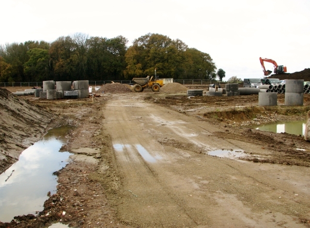
Image: © Evelyn Simak Taken: 13 Nov 2017
The track leads into the construction site of a new housing development by Bennett Homes, called "Milestones". The site, which is located in the parish of Bixley and Arminghall, covers the former location of Octagon Farm (the farmhouse was destroyed in a bombing raid on 8/9 May 1942, killing Lilian Mabel Spruce, the farmer's wife) and is spread out over the adjacent former crop fields. Work has recently commenced for the construction of 60 traditionally-built properties.
Images are licensed for reuse under creativecommons.org/licenses/by-sa/2.0
Image Location

Latitude
52.584361
Longitude
1.331798